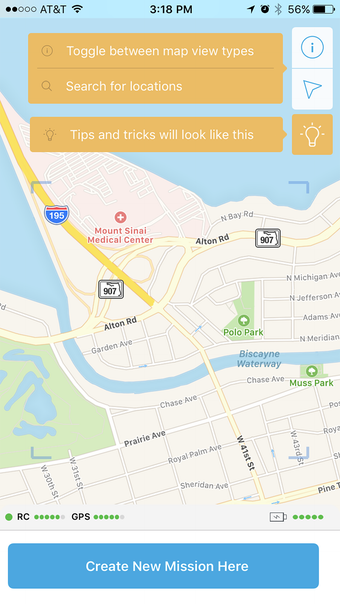
Flight1: Skycatch Drone Mission Planner
Flight1 by Skycatch Inc. is a comprehensive drone mission planning application designed for various drones like Skycatch Explore1, DJI P4, P4P, P4RTK, and M210RTK. This app streamlines aerial mapping processes from takeoff to landing, offering customizable flight settings to ensure precise image capture.
With Flight1, users can select areas of interest on satellite maps or import custom base maps, automatically generate optimal flight plans, and control flight path direction based on environmental factors. The app allows for seamless mission resumption, even after interruptions like battery changes, and saves plans for future data collection on sites.
Moreover, when integrated into the High Precision Package for Mining from Skycatch, Flight1 enables cloud processing of geotagged drone images into orthomaps, point clouds, 3D mesh, and DTMs. Users can further analyze and share processed data using Skycatch Data Hub or compatible software supporting point clouds.